
Brian Wernicke on Lithospheric Extension and the Basin and Range
Listen here or wherever you get your podcasts.
To a first approximation, tectonic plates behave like rigid blocks of lithosphere — but near their boundaries they get compressed or stretched. Compression is obvious: the edge of a plate crumples and throws up a mountain belt. Extension is usually hidden, because the stretched lithosphere subsides and the basins that form fill with sediment. The Basin and Range Province is a prime exception, its stretching recent enough and its land high enough to remain on open view — dozens of regularly spaced ranges between the Colorado Plateau and the Sierra Nevada, in a crust pulled out to about twice its original width.
Brian Wernicke has devoted the bulk of his long and prolific research career to its study. He is an Emeritus Professor in the Division of Geological and Planetary Sciences at Caltech.
Podcast Illustrations
Images courtesy of Brian Wernicke unless otherwise indicated.
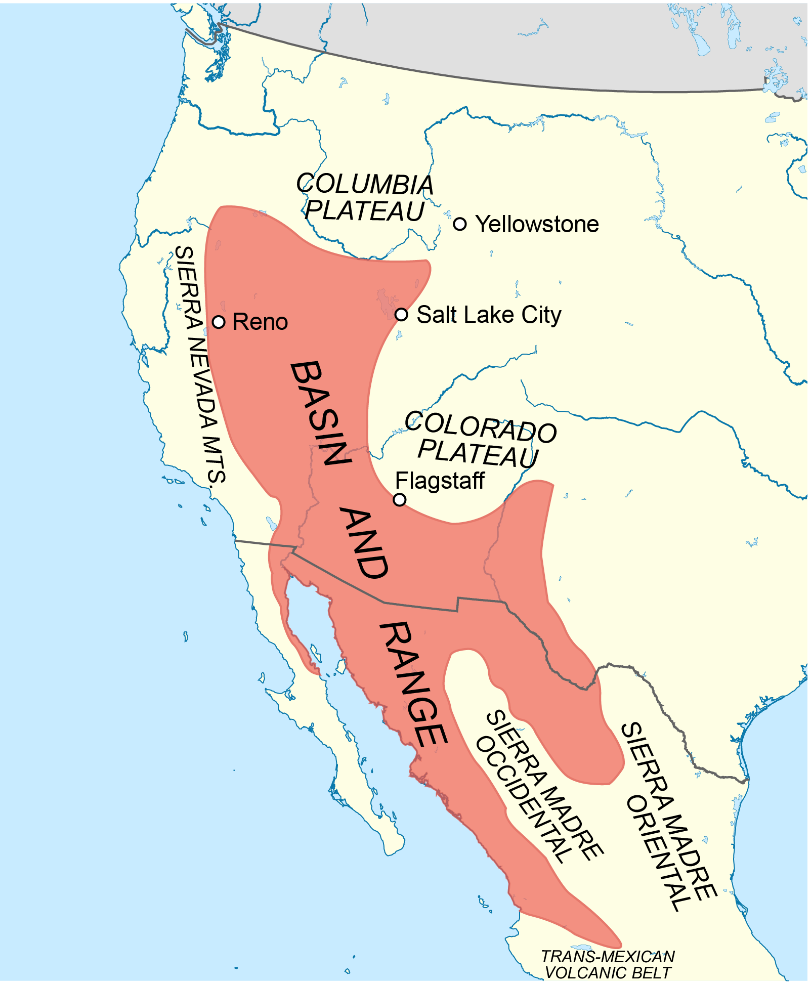
Map showing the location of the Basin and range province in North America.
Kathleen Smith
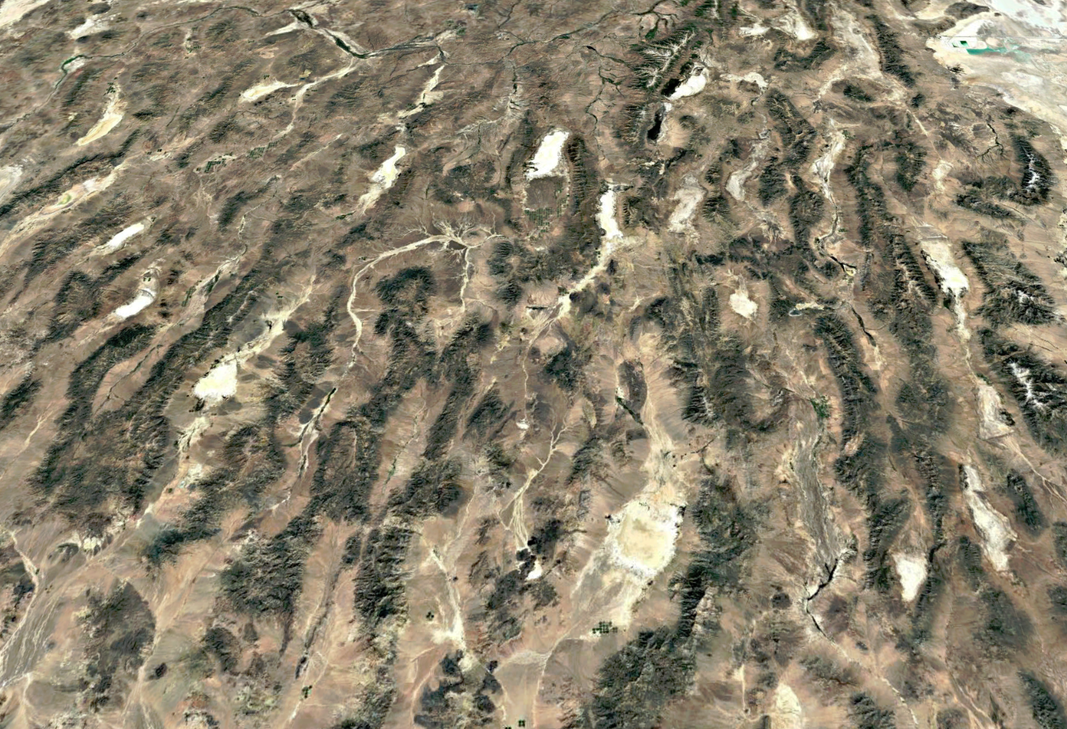
Google Earth image of a portion of the northern Basin and Range province in Nevada and Utah. Great Salt Lake is visible in the upper right. The pattern of repeating mountain ranges and valleys is apparent, which gave rise to the famous 1876 description by CLarence Dutton, the US Geological Survey geologist, that the ranges appeared to him as an army of caterpillars crawling northward out of Mexico.
Measuring the Extension using GPS
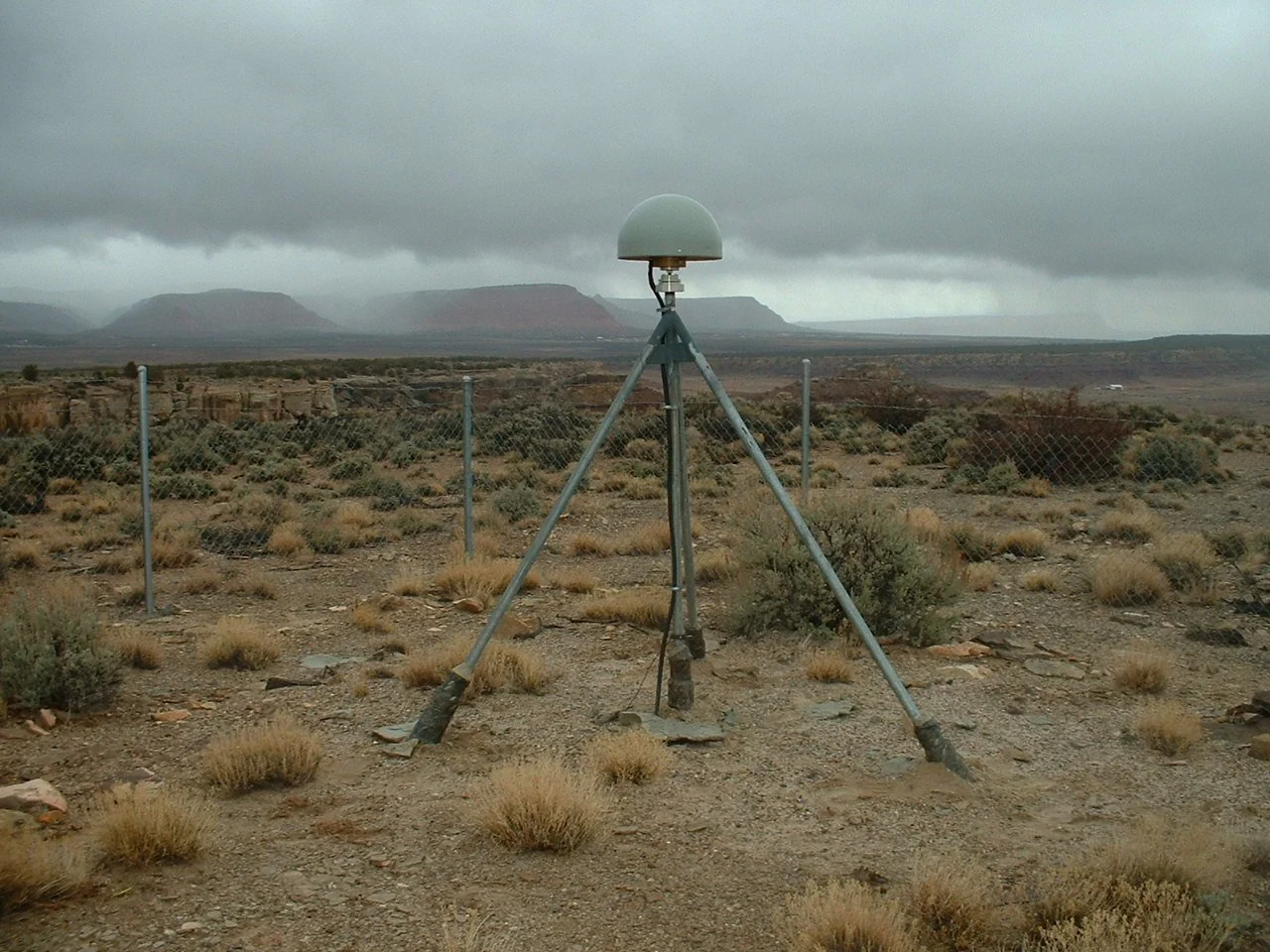
GPS antenna on the western Colorado Plateau near Fredonia, Ariz. In the podcast, Wernicke explains how his team, together with the space geodesy group at the Harvard-Smithsonian Astrophysical Observatory, set up a continuously recording geodetic network across the Basin and Range with sub-mm accuracy. They showed that the Basin and Range is extending and shearing with right-oblique elongation of baselines at a rate of about 12 mm/yr, and that the baseline velocities were speeding up and slowing down by about 1-2 mm/yr every 2 to 3 years.
Measuring the Extension Using Markers
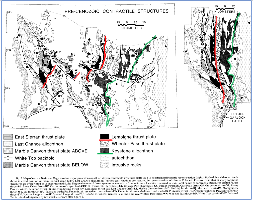
In the podcast, Wernicke describes how geological features that predate the last 20 million years of extension can be used to measure how much the Basin and Range has stretched. On the left, the Mesozoic thrust structures of the central Basin and Range as they lie today at the latitude of Las Vegas. On the right, the same structures restored to their positions before extension began. The green line marks the base of the Keystone thrust plate, and the red line the base of the Lemoigne–Clery plates. In the reconstruction they run close together and nearly straight, as they did when they formed; today they are dismembered and scattered across a far wider region. Piecing the fragments back together in this way shows that the Sierra Nevada has moved about 250 km away from the Colorado Plateau.
Snow, J.K. and Wernicke, B. (2000), American Journal of Science, 300(9), 659–719
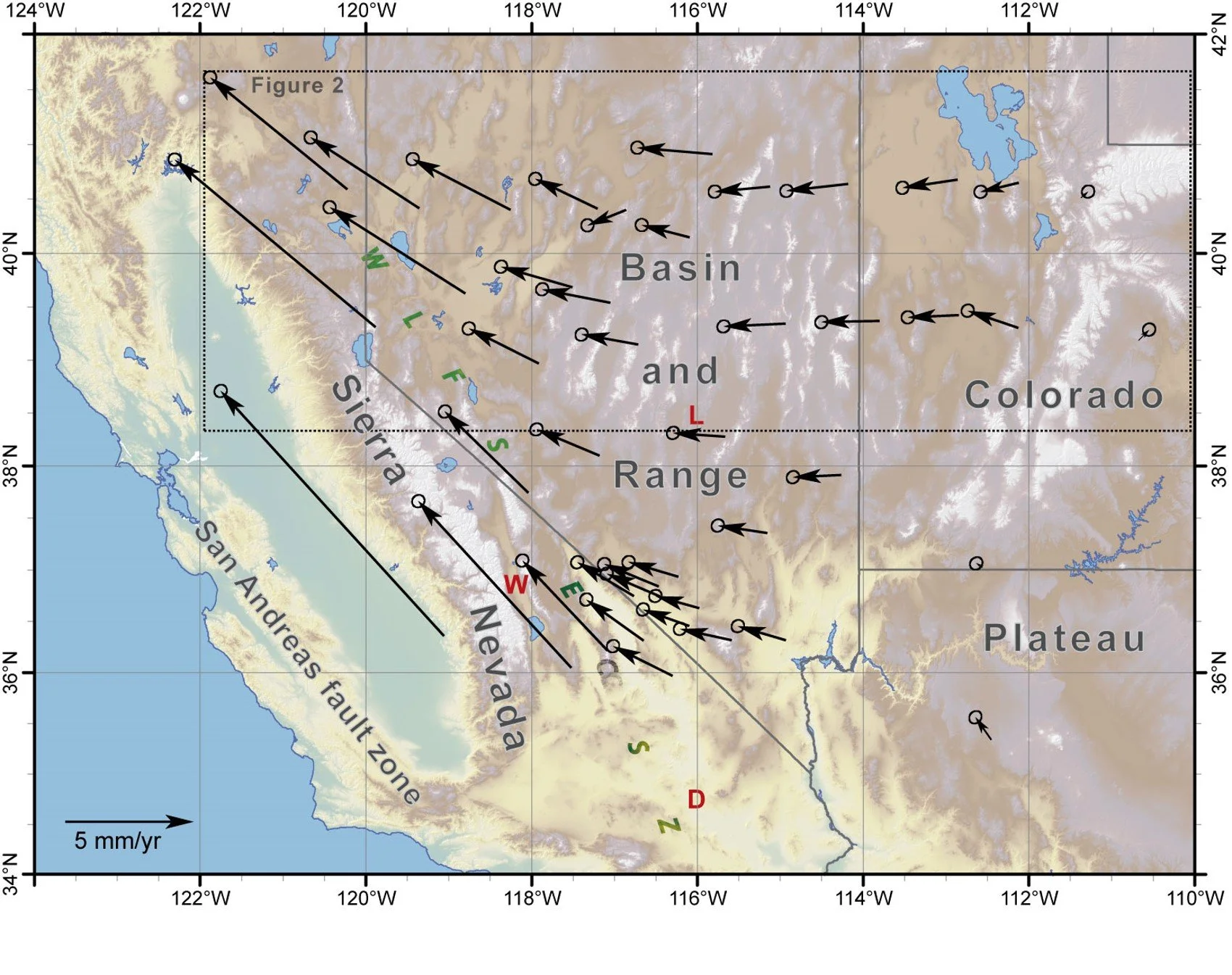
GPS velocity field: Color relief map of central and northern Basin and Range showing continuous GPS velocity field of sites from the Basin and Range geodetic network (BARGEN) from 1996 to 2006, relative to a fixed Colorado Plateau. Velocities increase westward and rotate northwest in sympathy with NW right-shear on the San Andreas fault zone, reaching values of 10 to 20 millimeters per year on the Sierra Nevada/Great Valley block.
Wernicke, B. et al. (2008), Journal of Geophysical Research, 113, B11409
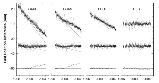
Each panel shows how one GPS station moved east or west over nearly a decade, measured against stable North America. Every black dot is a single day's position, and the scatter of about a millimeter gives a sense of the precision Wernicke describes in the podcast. The four stations form a transect, with GARL in the west and HEBE, in Utah, in the east. GARL drifts steadily westward — some 40 mm over the decade — while HEBE barely moves at all. That growing separation is the Basin and Range pulling itself apart. The lower traces in each panel show what remains once the steady motion and the seasonal wobble are stripped out: around 2000, the western stations slowed by about a millimeter a year, thought to reflect episodic yielding deep in the crust.
Davis, J.L. et al. (2006), Nature 441, 1131.
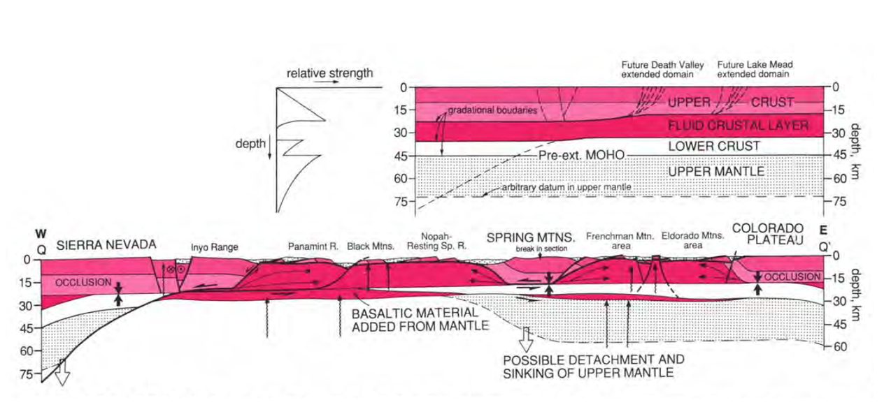
Central Basin and Range cross-section. Above: the crust as it was before extension, on a line near the latitude of Las Vegas. A strong upper crust rests on a weak, "fluid" middle layer — see the strength-versus-depth curve at left — and it is this weak layer that allows the upper crust to slide sideways. Faint fault traces mark where the Death Valley and Lake Mead regions would later pull apart.
Below: the same transect today, from the Sierra Nevada in the west to the Colorado Plateau in the east. Extension has been strikingly uneven. In a few wide domains, the upper crust has slid away along low-angle detachment faults, exhuming rock from fifteen kilometers down or more (deep red); between them, blocks such as the Spring Mountains and Inyo-Sierran terrain have hardly stretched at all — what Wernicke calls a sloppy hundred-kilometer checkerboard of gutted and intact ground. That older pattern is then overprinted by the younger, more closely spaced, deeply penetrating normal faults that tilt the crust into the (on average) thirty-kilometer blocks that we see today, e.g., the Inyo Range, the Paramint Range, the Black Mountains, and the relatively shallow intervening basins indicated by the dotted patterning. The result is Dutton's army of caterpillars. Basaltic material added from the mantle has partly offset the thinning.
Wernicke,B. (1992), Decade of North American Geology, Volume G-3, Geological Society of America
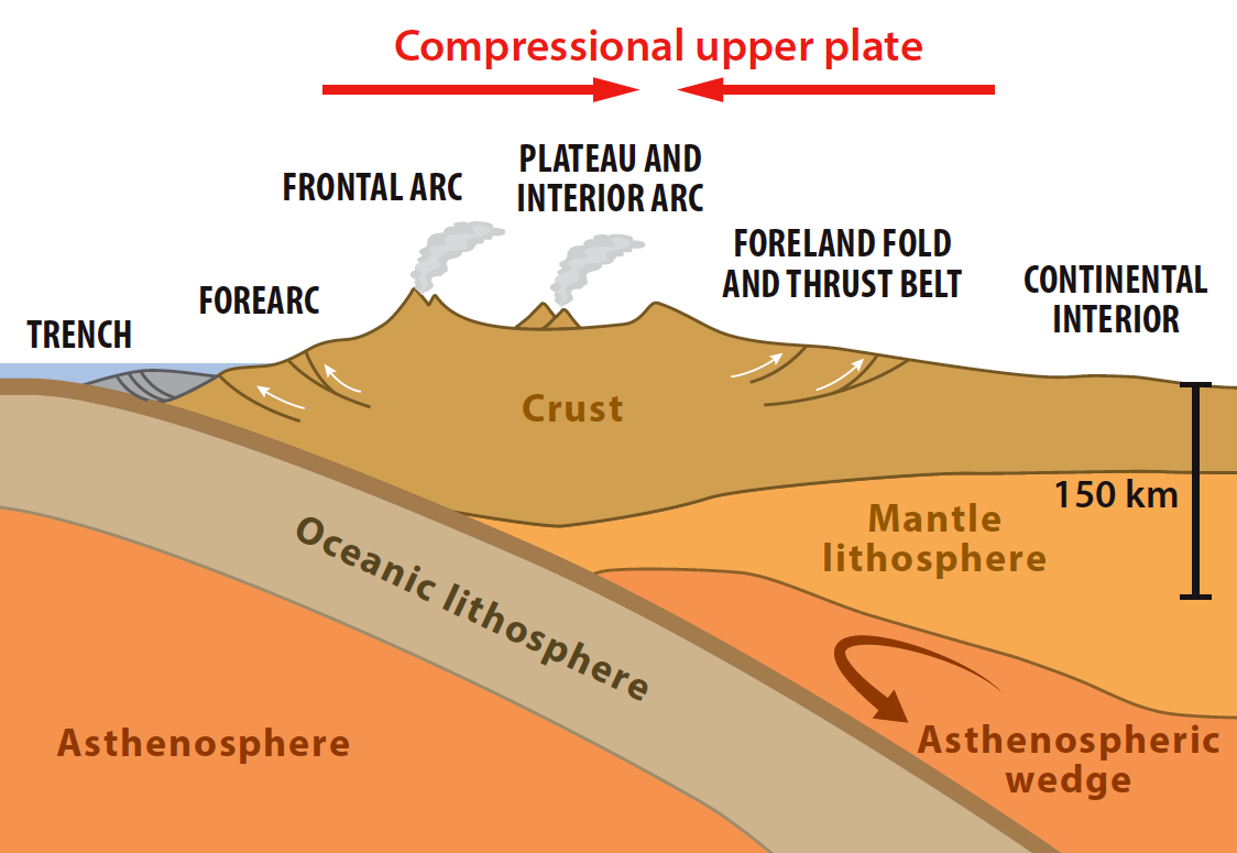
In the podcast, Wernicke explains that the western margin of North America had been thickened by very long-lived subduction of the Farallon plate, so that when Cenozoic extension began, the crust was about 70 km thick. Two- to three-fold extension then thinned it to about 35 km — normal thickness for continental crust. Yet the Basin and Range still averages about a kilometer in elevation, because the mantle lithosphere beneath it was thinned as well: hot, buoyant asthenosphere lies close below, holding the province up. Most extended regions, by contrast, subside and are buried by sediment.
Basin and Range Outcrops
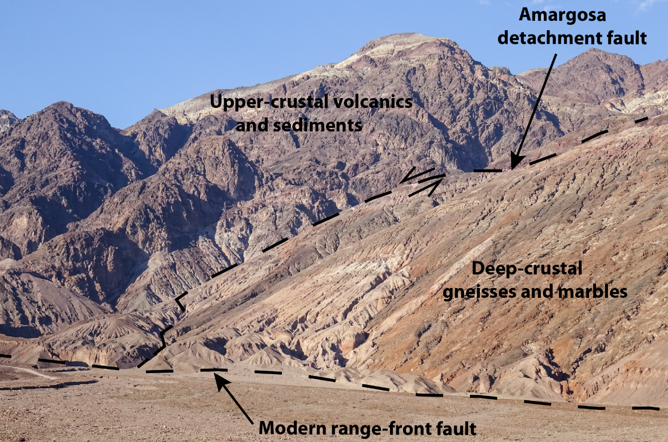
The Amargosa detachment fault, Black Mountains, Death Valley, California. The dashed line running up to the right is the detachment itself — a fault so gently inclined that it lies almost along the hillside rather than cutting across it. Above it sit ordinary upper-crustal volcanic rocks and sediments; below it, gneisses and marbles that were once 15 kilometers or more beneath the surface, crushed to breccia by the passage of the rocks above. Sliding along faults like this are how the deep crust was brought to the surface during extension, with the upper crust sliding away above them.
The second dashed line, running along the base of the range, is the modern range-front fault — a younger, much more steeply dipping structure that cuts off the old detachment where the two meet. This is the overprinting Wernicke describes in the podcast: the older exhumed terrains are chopped up by the younger Basin-and-Range faults, so the same deep-crustal rocks now stand at the summits of some ranges and lie kilometers beneath the floors of the neighboring valleys. Vertical relief in the view is about 1,600 m.
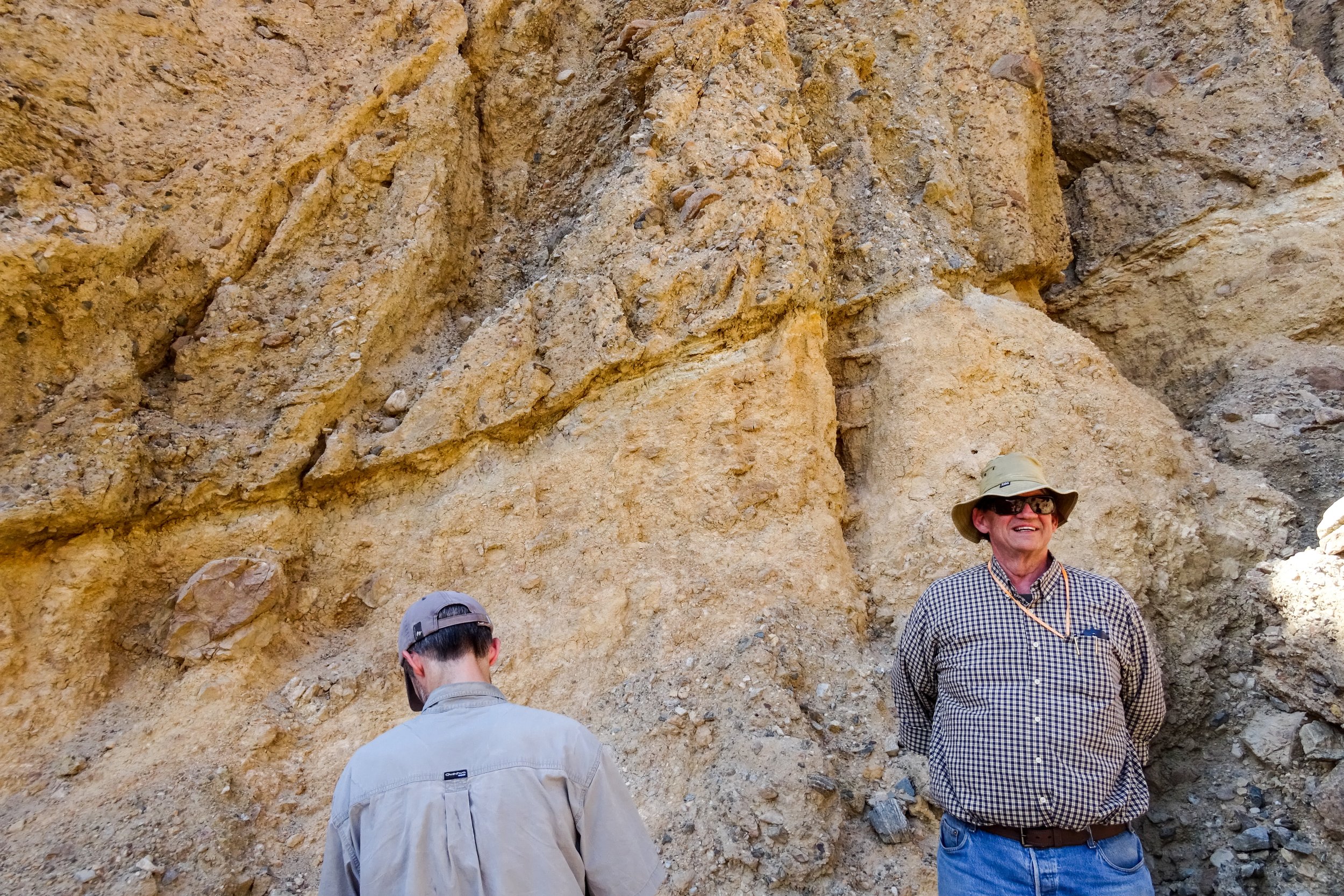
Outcrop photo of Amargosa detachment fault, placing upper crustal gravels over brecciated deep crustal marbles. Black Mountains metamorphic core complex, Death Valley, Calif. These faults accommodate exhumation of the deep crust during extension.
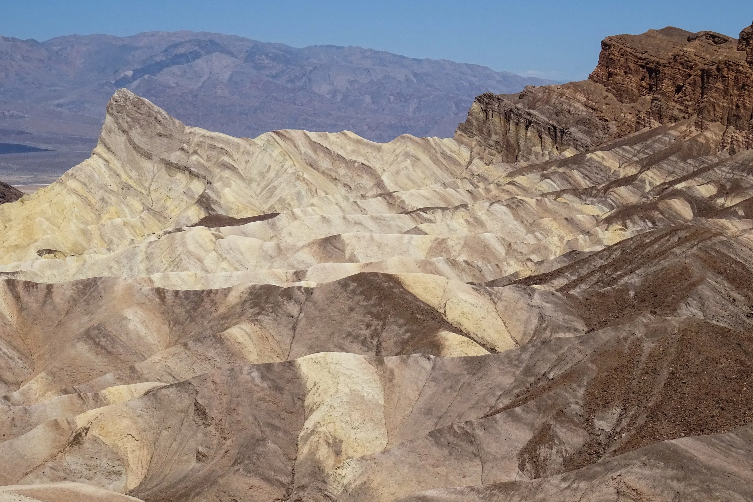
Upper-crustal extensional basin. View west toward tilted section of upper-crustal lake beds and alluvial fan deposits above the Amargosa detachment fault. Zabriskie Point, Death Valley, Calif. Width of view c. 700 m.
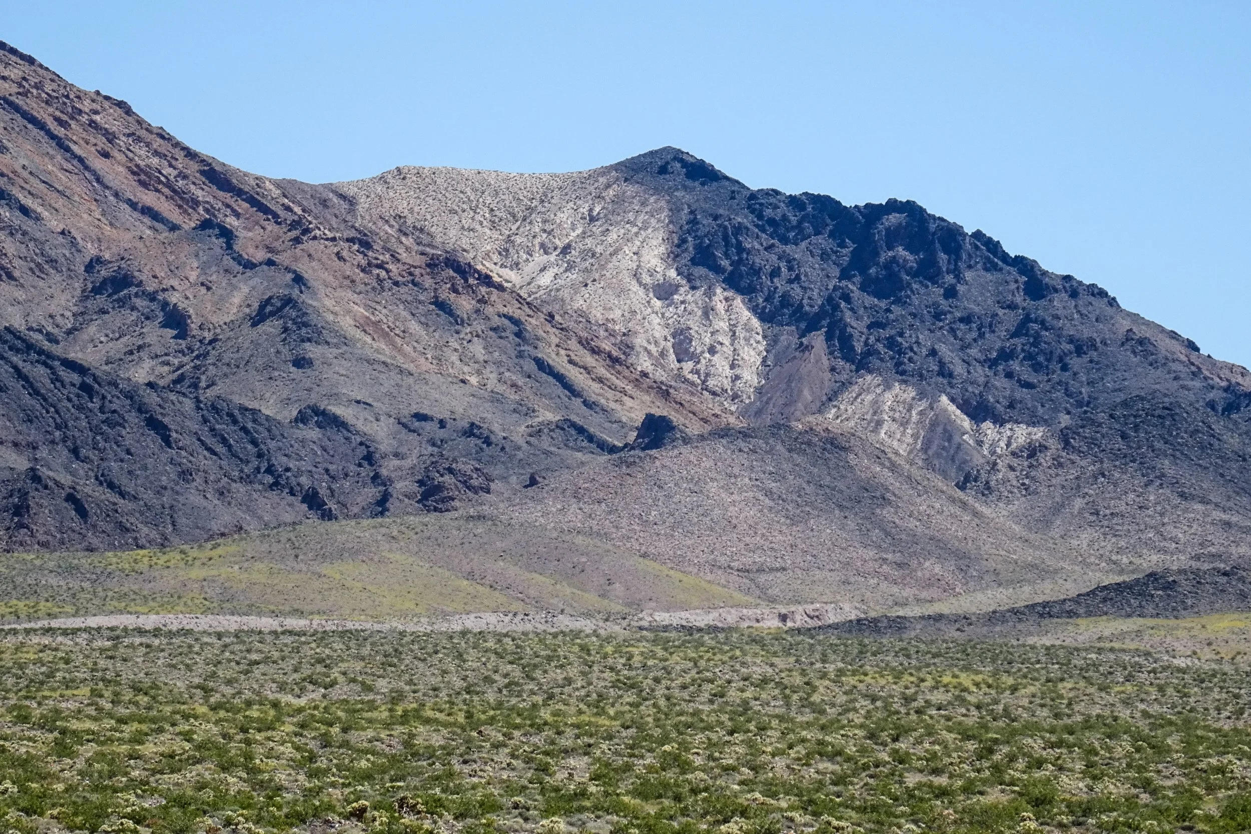
Tilted section of Ordovician strata typical of the eastern Great Basin region, composed in ascending order (left to right) marine limestones (gray and tan), quartzites (white) and dolomite (black). As Wernicke explains in the podcast, regional thickness contours of these and other strata provide ancient markers with which to reconstruct extension.
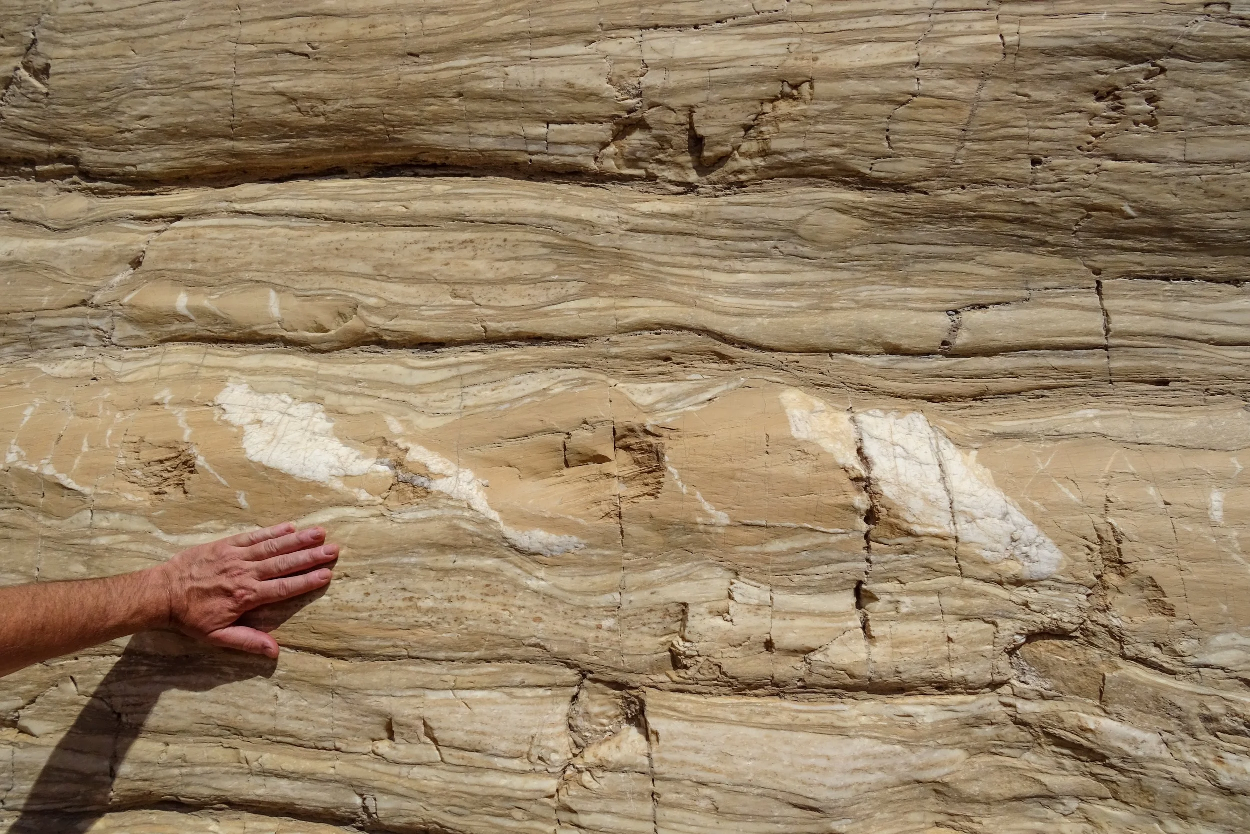
Deep-crustal limestone marble. Outcrop photo of limestone marble showing flow structure, veining and boudinage (lensing) that occurred at a temperature of about 400 °C.
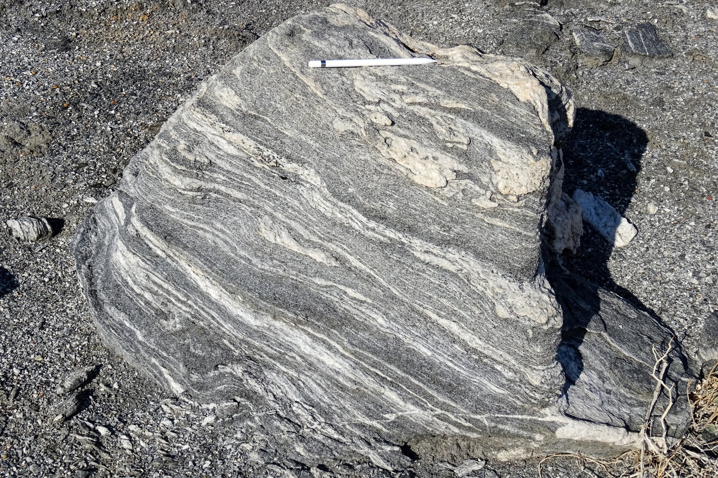
Deep crustal granitic gneisses. Alluvial boulder of deep crustal gneiss showing high-temperature flow (c. 600-700 °C). Black Mountains metamorphic core complex, Death Valley, Calif.
Animated reconstructions of plate movements and extension of the western margin of North America
Basin and Range history. Animation showing relative motions of interior range blocks in the Basin and Range from 36 million years ago to the present, with the reconstructed eastern boundary of the Pacific plate. From McQuarrie and Wernicke, 2005, Geosphere
Animation showing collision of the East Pacific Rise with western North America, leading to the demise of the Farallon plate. Growth of the Pacific-North America plate boundary over the last 30 million years changed the relative motion on the west side of the continent from near-normal convergence to NW-oblique divergence, resulting in major extension between the Sierra Nevada/Peninsular Ranges and the Colorado Plateau. This is one of the Tanya Atwater animations that Wernicke mentions in the podcast.
https://animations.geol.ucsb.edu/1_DownloadPage/Download_Page.html.