
Folarin Kolawole on Rifting
Listen here or wherever you get your podcasts.
From East Africa to southwest USA, many regions of the Earth’s continental lithosphere are rifting. We see evidence of past rifting along the passive margins of continents that were once contiguous but are now separated by wide oceans. How does something as apparently solid and durable as a continent break apart?
Kolawole is especially interested in the early stages of rifting, and in his research he uses field observation, seismic imaging, and mechanical study of rocks. He is Assistant Professor of Earth and Environmental Sciences, Seismology, Geology, and Tectonophysics at the Lamont-Doherty Earth Observatory of Columbia University.
Podcast Illustrations

Locations of active continental rifts with their extension velocities. In the podcast, Kolawole focuses on the East African rifting that extends from the northeast corner of the continent down to Malawi and Botswana. Kolawole explains why he thinks the rift, though only in its early phase today, will continue to stretch and eventually lead to a full continental breakup.
Heckenbach, E.L. et al.(2021), Geochemistry, Geophysics, Geosystems 22, e2020GC0095777
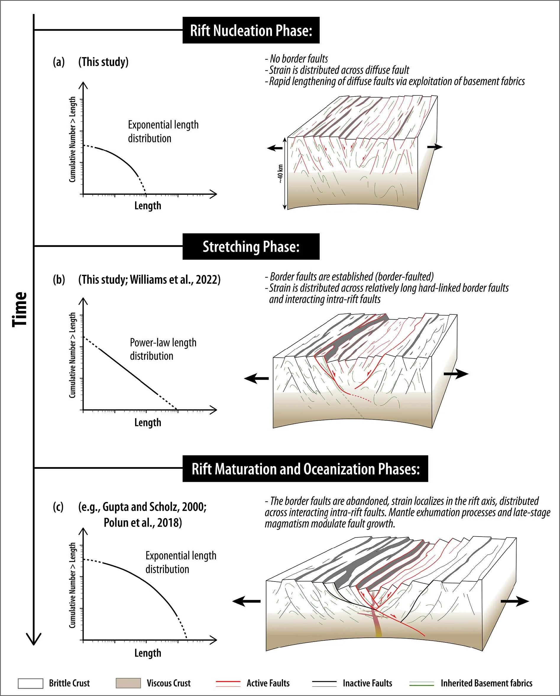
Cartoons illustrating the early phases of continental rifting described in the podcast. (a) Rift nucleation phase: diffuse faulting with faults lengthening as they exploit weaknesses in the crust. This results in the exponential distribution of fault lengths shown in the plot. Note, the plot is on a log-log scale. (b) Stretching phase, during which border faults are established and strain is distributed across the intra-rift faults and large border faults. (c) The maturation phases of rifting during which strain migrates to the rift axis. The faults become linked and lengthen.
Grant, C. et al. (2024), Earth and Planetary Science Letters 646, 118957

Diagram of the driving forces, resisting factors, and weakening processes that accompany rifting. In the podcast, Kolawole points out the importance of pre-existing zones of weakness in a continent in determining where rifting initiates. The block diagram illustrates a preexisting shear zone (1) that can determine a rift location and also break a rift into segments (2). Faults and shear zones (3) can weaken the crust as can necking and thermal weakening (4). Shallow intrusion of melt (5) as well as alteration of the rock (6) can also cause weakening. Outside forces caused by erosion (7) and sedimentation (8) also promote long-lived faulting.
Superplume Hypothesis

Seismic tomography cross-section of the mantle below Africa along the plane indicated by the red line in the inset map. Red indicates slower seismic wave speeds, which is interpreted as indicating warmer material. The section suggests a wide swathe of warmer mantle that impinges on the mantle-lithosphere boundary below northeast Africa. This is suggestive of the presence of a mantle superplume, which Kolawole describes as a driver of the East-African rift system that is likely to ensure the rift continues and eventually causes the continent to split apart on either side of a newly forming ocean.
Boyce, A. et al. (2023), Geochemistry, Geophysics, Geosystems 8, e2022GC010775

East African Rift volcanic fields (shaded grey) and major volcanoes (triangles).
Brune, S. et al. (2023), Nature Reviews Earth & Environment https://doi.org/10.1038/s43017-023-00391-3

Schematic representation of the mantle plume location beneath East Africa on the basis of seismic tomography. Plume structure at depth is consistent with the distribution of volcanism shown at left.
Brune, S. et al. (2023), Nature Reviews Earth & Environment https://doi.org/10.1038/s43017-023-00391-3
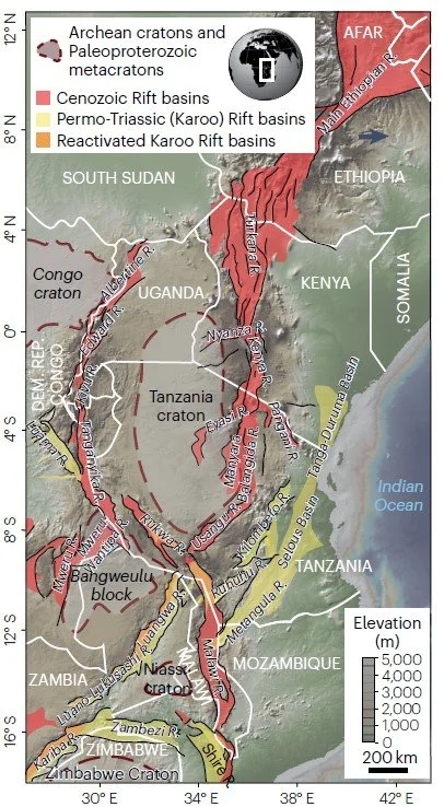
In the podcast, Kolawole explains that rifts preferentially occur along weaknesses in the lithosphere inherited from previous rifting episodes, and that rifts tend to skirt around hard, old cratonic regions. The map shows the location of recent rifting (pink) and Permo-Triassic rifting (yellow), and how they both avoid cratons, in this case the Tanzania craton and the Niassa craton.
Brune, S. et al. (2023), Nature Reviews Earth & Environment https://doi.org/10.1038/s43017-023-00391-3

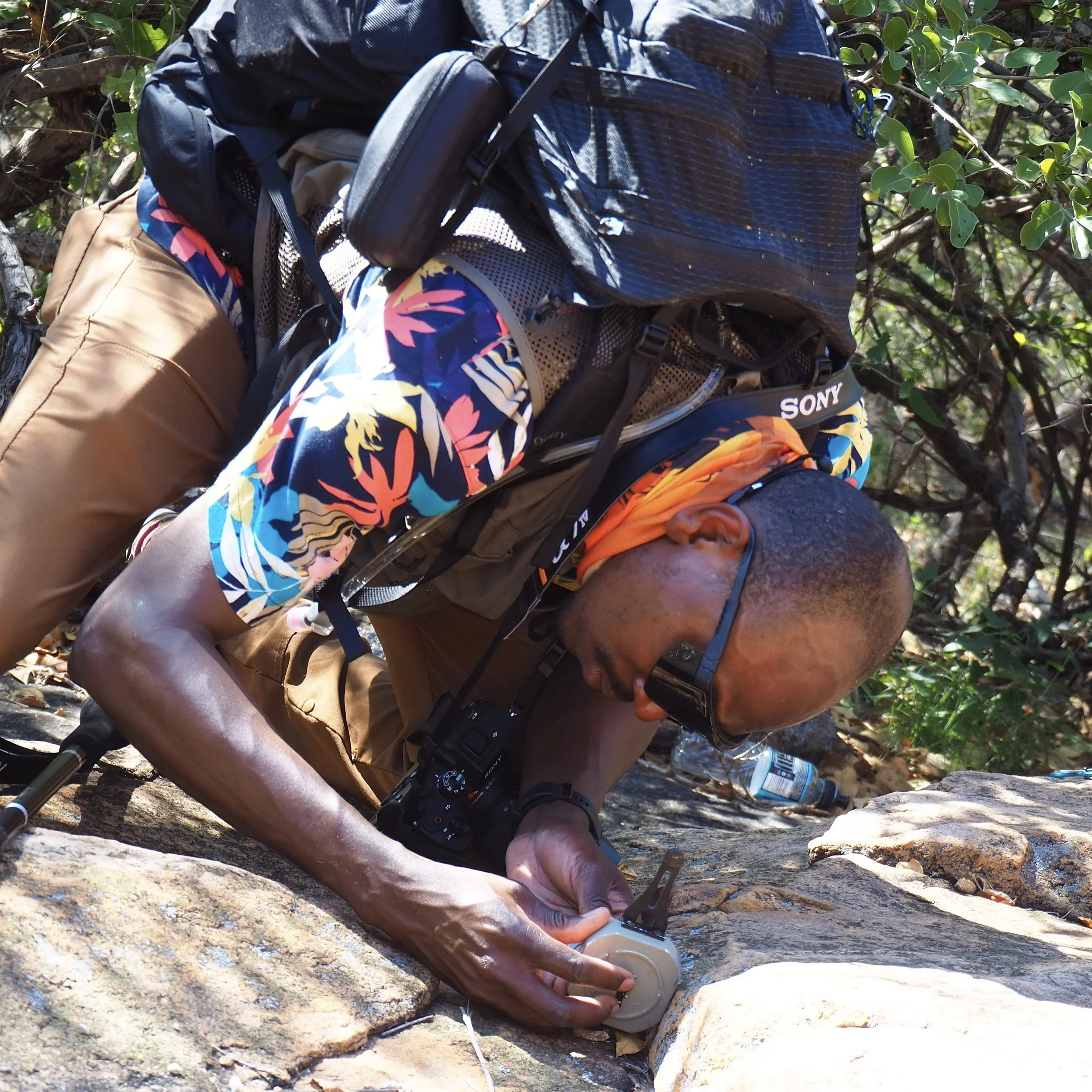
East African rift in southern Malawi showing the Nsanje fault, which is at the western boundary of the graben that runs along the rift axis.
Kolawole, F. et al. (2025), Extensional Tectonics: Rifting and Continental Extension, Geophysical Monograph 278, First Edition
Afar Region of Northern Ethiopia

Widespread faulting at the rift axis in the Afar region of northern Ethiopia.
David Ferguson

June 2009 volcanic eruption in the Afar region.
David Ferguson

Crevice formed in the Afar region during a sequence of large earthquakes in 2005 triggered by injection of magma into the shallow crust.
Lorraine Field